


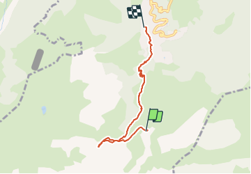

18,1 km | 34 km-effort

Usuario


Aplicación GPS de excursión GRATIS
 SityTrail
IGN / Institutos geográficos
SityTrail World
El mundo es suyo
Ruta Senderismo de 4,9 km a descubrir en Auvergne-Rhône-Alpes, Saboya, Les Avanchers-Valmorel. Esta ruta ha sido propuesta por dautriche.
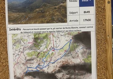
Petite mise en jambe pour réchauffer les articulation ... montée par le télécabine de Pierrefort et redescendre tranquillement et rejoindre le village du soleil. 5km facile pour tous les âges !


Senderismo

Esquí de fondo

Esquí de fondo
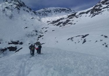
Esquí de fondo
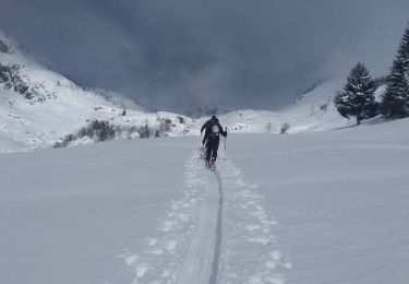
Esquí de fondo
Esquí de fondo
Senderismo
Senderismo
Senderismo